
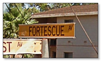
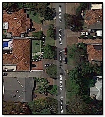
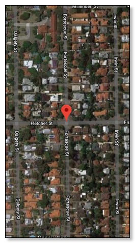
Fortescue Avenue Seaford
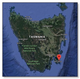
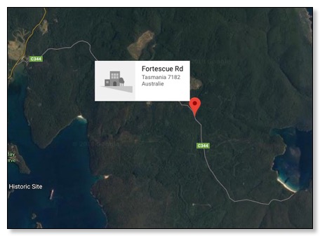
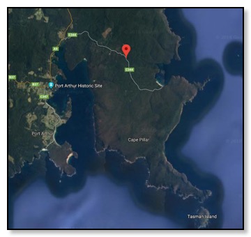
Fortescue Road Tasmanie
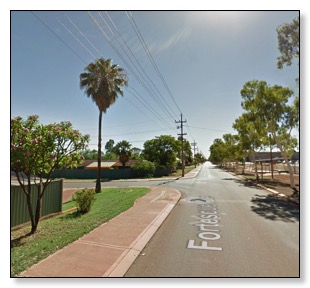
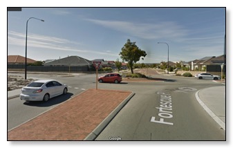
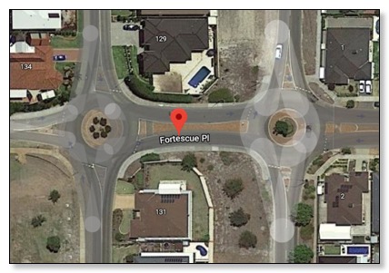
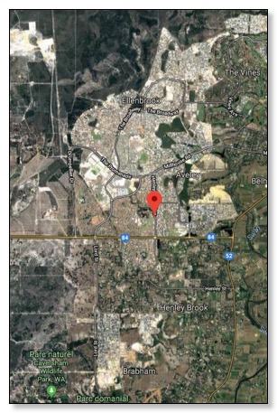
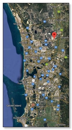
Fortescue Place
https://www.google.fr/maps/place/Fortescue+Pl,+Aveley+WA+6069,+Australie/@-31.9170914,115.6903033,103953m/data=!3m1!1e3!4m5!3m4!1s0x2a32b43b5b4278a7:0x20d0eb07632b4f8!8m2!3d-31.7911131!4d115.9786944
Fortescue Place
Aveley, WA (Australie-Occidentale) 6069
Australie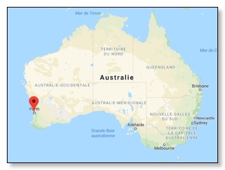
![]()


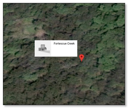
Fortescue Creek
https://www.google.fr/maps/@-31.7910371,115.9788488,3a,75y,96.41h,99.1t/data=!3m6!1e1!3m4!1sU-UpClxSVLquSFcyeD-hMQ!2e0!7i13312!8i6656
South Arm
Nouvelle-Galles du Sud 2449,
Australie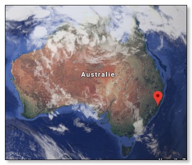
![]()

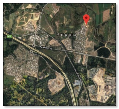
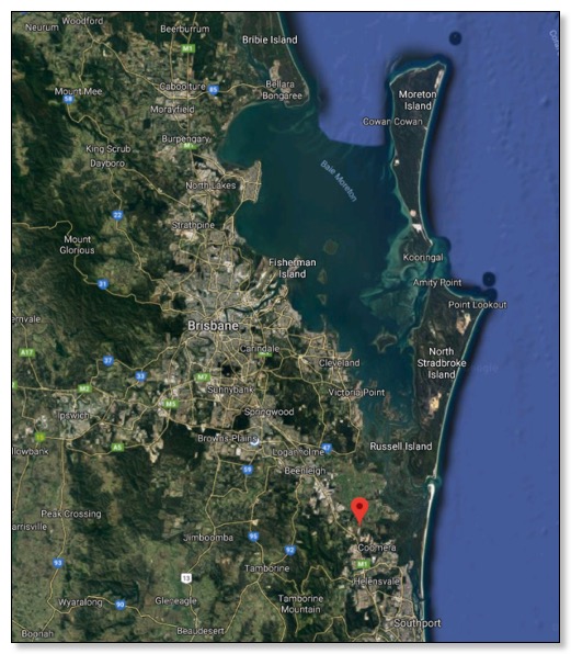
Fortescue Street Pimpama
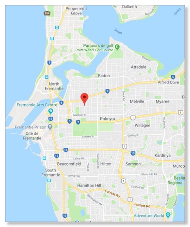
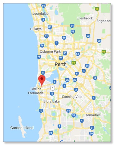
Fortescue Street Freemantle

 .
. 
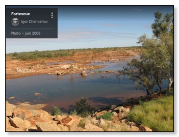
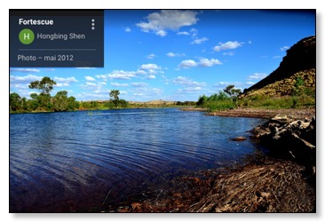
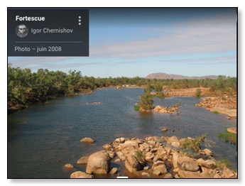
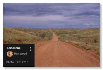
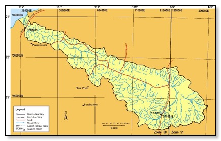
Fortescue River Basin
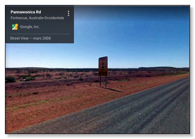
https://www.google.fr/maps/place/Fortescue+Australie-Occidentale+6716,+Australie/@-21.5919804,115.9371616,3a,75y,238.8h,103.31t/data=!3m6!1e1!3m4!1srEYyhnA53Ym0QwXZWE_VMA!2e0!7i3328!8i1664!4m13!1m7!3m6!1s0x2bf6db1bd3d07927:0x400f6382479cc10!2sFortescue+Australie-Occidentale+6716,+Australie!3b1!8m2!3d-21.623595!4d116.5461948!3m4!1s0x2bf6db1bd3d07927:0x400f6382479cc10!8m2!3d-21.623595!4d116.5461948
https://www.google.fr/maps/place/Fortescue+Australie-Occidentale+6716,+Australie/@-21.6235679,116.0145164,234796m/data=!3m2!1e3!4b1!4m8!1m2!2m1!1sFortescue+River!3m4!1s0x2bf6db1bd3d07927:0x400f6382479cc10!8m2!3d-21.6236011!4d116.5462303
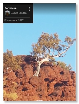
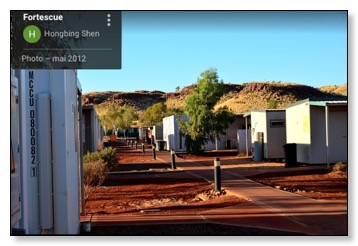
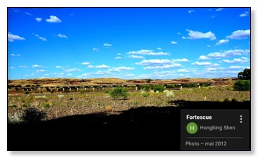
Fortescue
Australie-Occidentale 6716
Australie
![]()
![]()

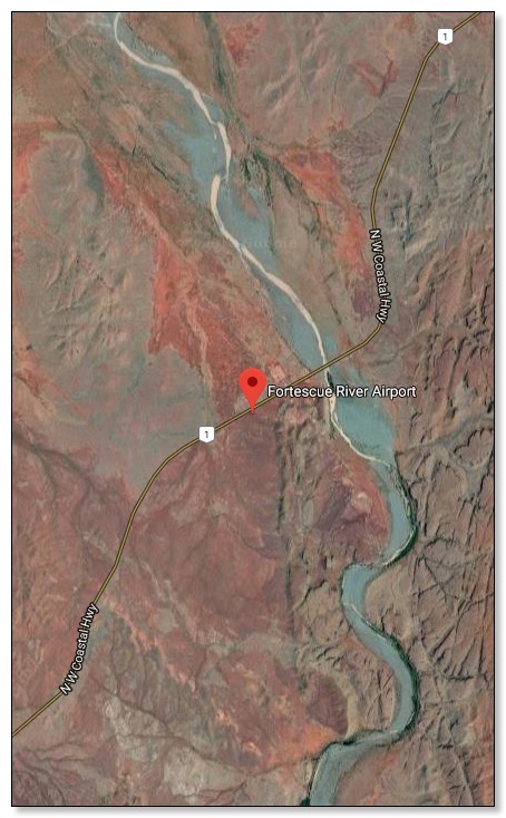
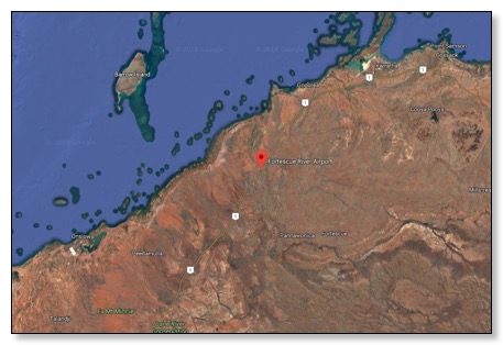
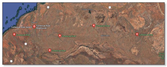
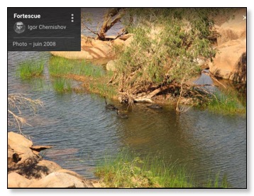
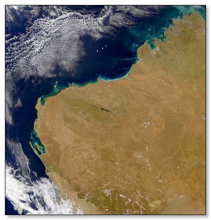
Fortescue River
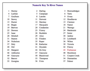
Major Australian Rivers
(nativefish.asn.au)
![]()
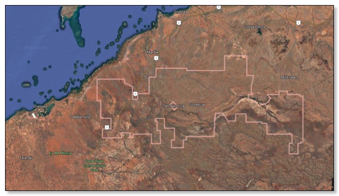
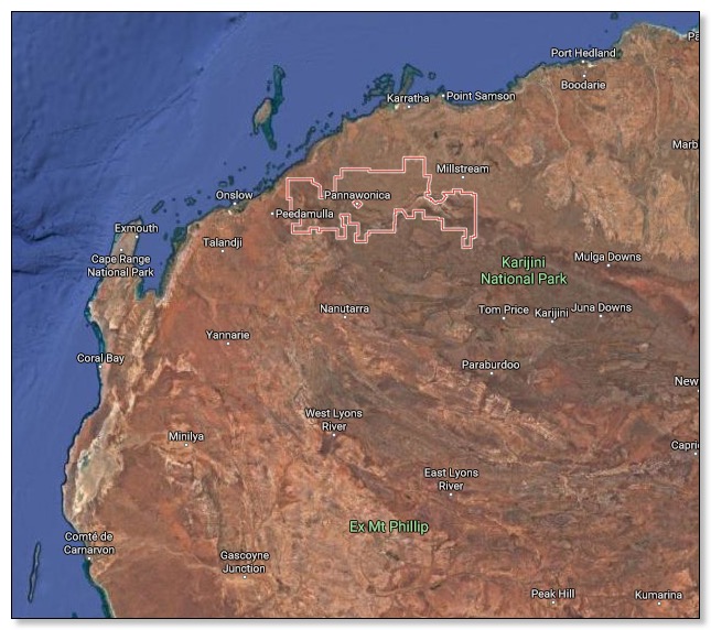
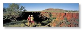
The Pilbara
Millstream-Chichester National Park
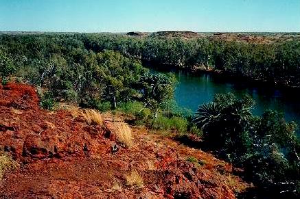
The 200,000 ha Millstream-Chichester National Park contains the Chichester Ranges which rise abruptly from the coastal plain. The Chichesters consist of a stony plateau with deep gorges and rocky pools along the edges. To the south of the park the Fortescue river has created the Millstream oasis.
Permanent running springs feed deep pools with introduced date palms and water lilies. Millstream is the home on the Livingstonia palm, one of the few palm trees native to the northwest of Australia.
![]()
Millstream National Park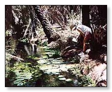
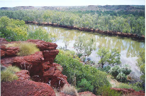
The Chichester Range rises sharply from the coastal plain and includes rocky peaks, tranquil gorges, and hidden rock pools such as Python Pool. Scattered white-barked gums and spiky spinifex clumps cover the stony plateau, which gradually slopes down to the bed of the Fortescue River.
In the midst of this landscape is the remarkable oasis of Millstream, where fresh water springs from an aquifer to create the lushly tropical Chinderwarriner Pool. Paperbark and palm trees surround this deep pool on the Fortescue River...
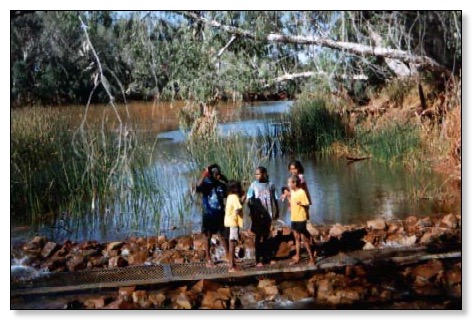
The broad area of land straddling the Fortescue River, from the Hamersley Range through to the Chichester escarpment is the homeland of the Yinjibarndi people. Ngarrari (Millstream) was an important camp site for inter-tribal meetings. Visitors camped beside Chinderwarriner Pool, where they feasted on fresh fish and edible plant roots, harvested wood for spears and collected rocks for ritual purposes. Today the Yinjibarndi people maintain close ties with their land and have been trained and employed as rangers and contract workers...
![]()
![]()
![]()
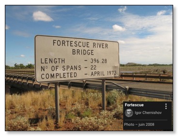
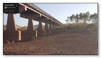
Fortescue River. A tranquil spot in WA's Pilbara. This river supplies the
water for Tom Price, hence swimming is not permitted. However there
are plenty of places for swimming in the area. Circular Pool is near by and
has also a great camping area.![]()
14-Day Pilbara, Broome & West Kimberley Tour
Departure Date
7th July 2001
(caseytours.com.au)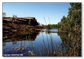
…
DAY 5 [CP] We continue north crossing the Ashburton and Fortesque Rivers to Dampier, Karratha, Roebourne and the historic Port of Cossack.
In the afternoon onto Port Hedland.
…
DAY 12 [CP] Some of the gorges we see today in these ranges are as impressive as you would see in any part of Australia.
We visit Yampire, Dales, Circular Pool and Fortescue Fall; onto Newman.
…![]()
NATIONAL WILDERNESS RED INDEX
Published by the Colong Foundation for Wilderness Ltd. 30/09/94
Level 2, 362 Kent Street, Sydney, NSW, 2000.
Name: FORTESCUE RIVER
DESCRIPTION : The Fortescue River area consists largely of a series of low hills and streams
based on Proterozoic basalts. The hills reach to 200 to 300 metres in height.
The Fortescue River flows from east to west just to the south of the area.
Hummock grasslands and scattered eucalypt woodland are the dominant vegetation
types.
DAMS : A proposal exists to dam the Fortescue River to provide water to townships of
the Pilbara region.![]()
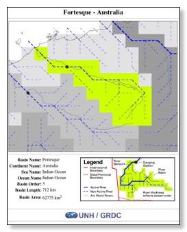
Fortescue river
Basin Name : Fortesque
Continent Name : Australia
Ocean Name : Indian Ocean
Basin Length : 712 km
Basin Area : 62775 km2![]()
Hamersley Range - Britannica.com
…
Mountains in the Pilbara region, northwestern Western Australia, extending east-southeast for 160 miles (260 km) south of the Fortescue River. Part of an ancient tableland broken by faults and gorges, the range terminates in rocky headlands and coral islets at the Indian Ocean. It includes the highest peak in Western Australia, Mount Meharry (4,111 feet [1,253 m]), which lies southeast of Wittenoom Gorge.
…
Hamersley Ranges
(discoverwest.com.au)
The Hamersley Ranges stretch for more than 400km through the Pilbara, forming wild and magnificent panoramas. Spectacular gorges have been carved by the waters of the Fortescue and other rivers. Sheer walls of rock are layered in colours from red to green and blue to pink in the changing sunlight. The gorges are up to 100m deep, with the water flow at their bases sometimes only one metre wide. Others have wide crystal-clear pools reflecting the blue skies. Lush green vegetation thrives and the gorges are cool oases to swim in and escape the brilliant sunshine. Within the huge Karijini (Hamersley Range) National Park there are many well known gorges, including Dales Gorge, its strata in horizontal stripes of blue, mauve, red and brown and dating back 2000 million years
![]()
Casey Australia Tours 14-Day![]()
...
DAY 5 [CP] We continue north crossing the Ashburton and Fortesque Rivers to Dampier, Karratha, Roebourne and the historic Port of Cossack. In the afternoon onto Port Hedland.
...
DAY 12 [CP] Some of the gorges we see today in these ranges are as impressive as you would see in any part of Australia. We visit Yampire, Dales, Circular Pool and Fortescue Fall; onto Newman.
...
![]()
Park of the Month - June 1997
Millstream-Chichester National Park
Most of the 200,000 hectare Millstream-Chichester National Park is a landscape of rolling hills, spectacular escarpments and winding tree-lined watercourses.
The Chichester Range rises sharply from the coastal plain and includes rocky peaks, tranquil gorges, and hidden rock pools such as Python Pool. Scattered white-barked gums and spiky spinifex clumps cover the stony plateau, which gradually slopes down to the bed of the Fortescue River.
In the midst of this landscape is the remarkable oasis of Millstream, where fresh water springs from an aquifer to create the lushly tropical Chinderwarriner Pool. Paperbark and palm trees surround this deep pool on the Fortescue River.
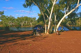
The park's shady camping areas near deep pools at Crossing Pool and Deep Reach attract tourists and locals all year round, but winter is the best time to visit. The cool season between May and August, experiences little rain, with day time temperatures around 26º Celcius.
The area has an interesting cultural history. It has long been a focal point for the Yinjibarndi people and was an active pastoral station for more than 100 years. Previously two separate parks, the area was expanded into one park in 1982, and it has significant natural, recreational and cultural values.
The broad area of land straddling the Fortescue River, from the Hamersley Range through to the Chichester escarpment is the homeland of the Yinjibarndi people. Ngarrari (Millstream) was an important camp site for inter-tribal meetings. Visitors camped beside Chinderwarriner Pool, where they feasted on fresh fish and edible plant roots, harvested wood for spears and collected rocks for ritual purposes. Today the Yinjibarndi people maintain close ties with their land and have been trained and employed as rangers and contract workers.
Millstream was named in 1861 by the explorer F T Gregory, who reported its favourable grazing prospects. The pastoral lease, first taken up in 1865 changed hands several times before Les Gordon assumed management of the property in 1923. In its heyday the station covered more than 400,000 hectares and ran 55,000 sheep. The homestead which now houses the visitor centre, was built in 1919 and was home to the Gordon family until 1964.
![]()
Millstream
Millstream is in the Chichester National Park, and is one of the most beautiful spots around. A long drive on gravel tracks, through barren countryside, eventually leads to this oasis in the desert.
In thousands of years past, our ancestors called Millstream or 'Ngarrari' home and it was also an important camp site for inter-tribal meetings. At these meetings, visitors often camped beside Chinderwariner Pool, better known today as Crystal Pool. There they feasted on fish and plant roots.
Covering an area of almost 200,000 square hectares, Millstream-Chichester National Park is located about 150 kilometres from Roebourne. The entire Chichester Ranges and Millstream area are stooped in both cultural & geological history. The water’s that feed the Millstream Oasis arrive via an aquifer or natural underground reserve which is contained within the surrounding dolomite rock. This huge reserve is believed to contain in excess of 1700 million cubic metres of water and cover an area of almost 2000 square kilometres. Aided also by the run-off from the Hamersley Ranges via the Fortescue River, with this vast water supply ensures Millstream to be a year round oasis with permanent water and inviting swimming holes. To our people (the Yindjibarndi people are the traditional Aboriginal people of the area), Millstream and its surrounding waterways holds great cultural significance. The lush oasis of the Millstream wetlands, stands in vast contrast to it’s surrounding landscape consisting of spectacular escarpments,
rolling spinifex-covered hills and winding tree-lined watercourses. The area also has its fair share of European history as the area was extensively used by early European settlers as an active pastoral station for more than 100 years. The Millstream Visitors Center is located in some of the original homestead buildings as well as the remnants of the gardens, cook house and other structures used by the homestead staff. Well maintained public camping facilities are located near deep cool pools, with gas BBQs and wood supplied for campfires.
.JPG)
![]()
MILLSTREAM NATIONAL PARK![]()
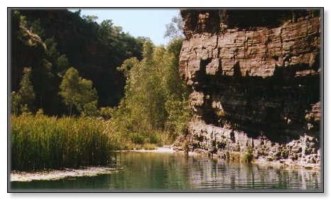
We are now driving along the Fortescue river, which widens out into permanent pools.![]()
ROEBOURNE
Situated on North West Coastal Highway, Roebourne is a central base for touring the are to see such places as Cossack, Point Samson, Harding River Dam, Millstream, Python Pool, Karratha, Wittenoom and Tom Price. The many well preserved and restored historic attractions around Roeboume are a must for the history buffs.
Roebourne, the gateway to Australia’s greatest oasis Millstream, which emerges out of the stark rugged iron ore country of the Chichester National Park, is a tropical paradise set on the Fortescue River with tall trees, palms, water lillies and ferns surrounding a huge lake.
![]()
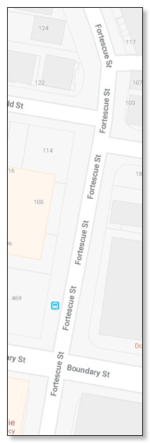
Fortescue Gorge
http://www.discoverwest.com.au/western_australia/karijini.html![]()
Karijini Western Australia
Fortesque Gorge
The historic town of Roebourne and the ghost town of Cossack are amongst the oldest settlements in WA
Most of the walking tracks and facilities are concentrated along the north eastern escarpments where the most beautiful gorges lie.
Each gorge is remarkably different from the next.
There are several short walks along cliff tops;
the most noteworthy culminating at Oxer lookout that overlooks the junction of four spectacular chasms Hancock, Joffre, Red and Weano gorges.
Visitors can venture into the gorges but must be fit and ready to dip into the ice-cold waters and cling to rock ledges whilst following narrow paths.
The waterfalls at Joffre Gorge and Fortesque Gorge are definite highlights.
![]()
Fortescue Mount
Activities
Canoe Bay |
![]()
Fortescue Group
![]()
http://www.linex.com.au/ge_select.html
TARGET SELECTION. (2001)
…
WOODALL, R., 1985. Limited vision: A personal experience of mining geology and scientific mineral exploration. Australian Journal of Earth Sciences 32:231-237.
"In 1957 WMC began its search for a sediment hosted copper deposit in the vast Proterozoic of Australia, a search which would last 19 years and cost $12 million in today's money terms. Our perception at the time dictated that the search be concentrated where there were signs of copper in favourable host rocks - shales like those of the African Copperbelt or lavas like those of Michigan. Limited vision took us to the remote Warburton Ranges, and to the Fortesque Group in the Pilbara. Only when science opened our eyes to the importance of looking for copper where events may have sourced copper did improved vision enable us to see the potential of the Stuart Shelf in South Australia, where tectonics and geophysics subsequently guided us to Australia's greatest ore deposit at Olympic Dam." p232.
…
![]()
http://www.tsrc.uwa.edu.au/people/rhack/rhack.html
Ron Hackney (2001)
Position: PhD Student
Department of Geology & Geophysics
The University of Western Australia
Nedlands, Western Australia 6907
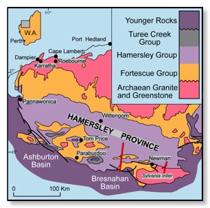
The main focus of this project is to use new and existing gravity data to aid in the interpretation of the geology of the Hamersley Province. Below you will find a description of this research and the larger project of which this research is part.
…
The Hamersley Province of Western Australia comprises a thick succession (up to 5-6 km) of largely volcanic rocks (Fortescue Group) overlain by a 2.5 km thick succession dominated by banded iron-formation units (Hamersley Group) (e.g. Harmsworth et al., 1990). The province contains an early Proterozoic foreland fold-and-thrust belt that hosts ten percent of known world reserves of iron ore. Renewed company interest in extending ore reserves requires knowledge of the subsurface structural geology, which will be gained by incorporating surface geological data with gravity, magnetic and seismic data. Data from two multi-channel seismic profiles obtained in 1997 (Figure 1) will constrain structural sections through the region, and gravity and magnetic measurements will be used to discriminate between possible alternative subsurface sections. Balanced structural sections across the fold-and-thrust belt will form the basis for an integrated model of the structural evolution of the Hamersley Province.
…
The longer of the two seismic lines, situated approximately 100 km west of Newman, begins in gently folded late Archaean to early Proterozoic Hamersley Group rocks close to the undeformed foreland and continues south into a fold belt dominated at all scales by north-verging asymmetric folds. The southern margin of the fold belt is bounded by a major normal fault that brings the younger sedimentary rocks of the late Paleoproterozoic Bresnahan Basin into contact with dolerites of the late Archaean upper Fortescue Group.
…
A shorter line, 20 km east of Newman, runs approximately 40 km north-south from Hamersley Group rocks that progressively become more intensely deformed to the south before crossing into the Sylvania Inlier (Figure 1). This Archaean granite-greenstone terrain is juxtaposed against the younger rocks of the Hamersley and Fortescue Groups, and the boundary is interpreted as a south-dipping fault contact involving over-thrusting of basement during formation of the fold-and-thrust belt (Tyler & Thorne, 1990; Tyler, 1991). Geophysical data along this seismic line provide important constraints for modelling the geometry of this important boundary.
![]()
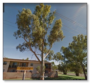
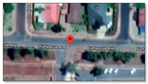
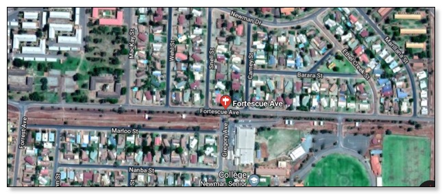
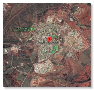
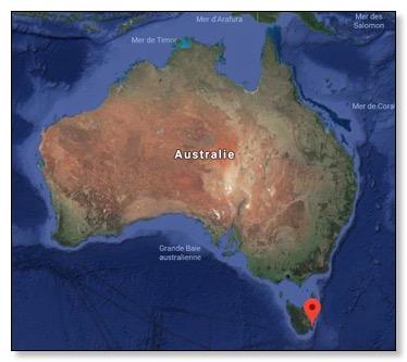
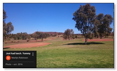
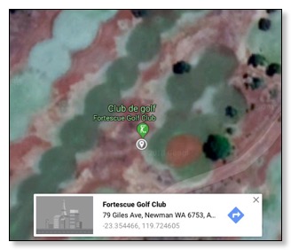
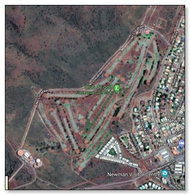
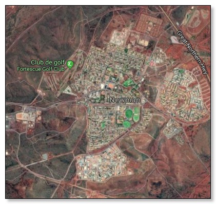
Fortescue Golf Club
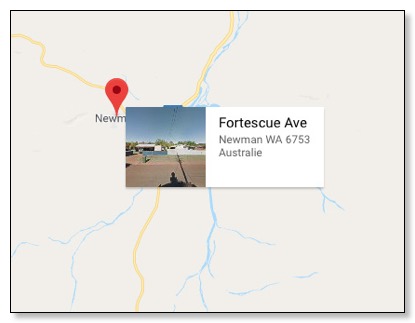
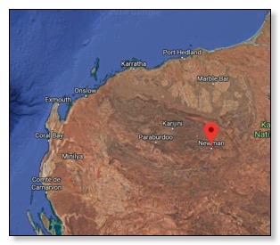
https://www.google.fr/maps/place/Fortescue+Golf+Club/@-23.3541567,119.7233457,395m/data=!3m1!1e3!4m13!1m7!3m6!1s0x2b93b4e7bca293e5:0x2917388eb031cfb2!2sFortescue+Ave,+Newman+WA+6753,+Australie!3b1!8m2!3d-23.3601234!4d119.7333965!3m4!1s0x2b93b4c6ad143dd3:0xf00f63907893d90!8m2!3d-23.3544505!4d119.7246078
79 Giles Ave,
Newman WA 6753,
Australie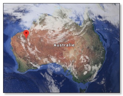 .
. 
![]()
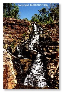
Fortescue Falls
Karijini National Park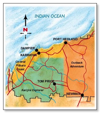
![]()
Park of the Month - August 1996
Karijini (formerly Hamersley Range National Park) is the second largest national park in WA.
A party led by explorer F.T. Gregory explored the area in 1861. He named the Hamersley Range, on which the park is centred, after his friend Edward Hamersley.
Situated just north of the Tropic of Capricorn, the park's climate can best be described as tropical semi-desert.
A highly variable, mainly summer rainfall of 250–350 mm, often associated with thunderstorms and cyclones, is accompanied by temperatures frequently topping 40 degrees Celsius.
The ideal times to visit the park are late autumn, winter and early spring. Winter days are warm and clear, but nights are cold and sometimes frosty.
Karijini National Park protects many different wildlife habitats, landscapes, plants and animals of the Pilbara.
Wildflowers vary with the seasons. In the cooler months the land is covered with yellow-flowering cassias and wattles, northern bluebells and purple mulla-mullas.
After rain many plants bloom profusely.
It is also home to a variety of birds, red kangaroos and euros, rock-wallabies, echidnas and several bat species.
Geckos, goannas, dragons, legless lizards, pythons and other snakes are abundant.
Huge termite mounds are a feature of the landscape and the rock piles of the rare pebble mound mouse may be found in spinifex country.
... What to see and do:
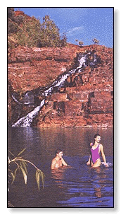
... Fortescue Falls
Walk down through the changing vegetation of the iron-rich gorge walls to the park's only permanent waterfall. (800 metres, 2-hour return walk.)
The Fortescue falls are spraying over into a green pool, cool against the red walls.![]()
10 Day North West Explorer (1999-2000 )
safaris.net.au
This 10 day Adventure from Perth to Broome, is full of fantastic scenery, excellent wildlife and great activities.
The tour is a combination of our "West Coast Explorer" safari and "Karijini" safari,
and combines the best of Western Australia's coastline with the spectacular Pilbara outback.
The tour is fully accommodated (budget accommodation), with all meals supplied.
…
Day 8: Today we head for Karijini National Park.
This area contains some of the World's oldest rock formations and is renowned for it's spectacular scenery.
Once inside Karijini National Park, we travel to Oxer Lookout which is the junction of 4 spectacular gorges.
We then descend into Weano Gorge and take the short trek through the bottom of the gorge to Handrail Pool.
If time permits we will take a look at Knox Gorge and Joffre Falls Lookout.
Moving on through the park we take another walk into Kalamina Gorge before heading for Fortescue Falls where we walk along the cliff tops to Circular Pool lookout,
then take the steep descent into Dales Gorge.
We then take the interesting trek from Circular Pool to Fortescue Falls, keep your eyes open for some Water monitors basking on rocks along the way.
The pool at Fortescue Falls is perfect for cooling off after your walk before climbing the steps out of the gorge back to the vehicle at the top.
These is time for a browse through the Aboriginal Centre in the park before taking one of only two breaks in the Ranges to get to the other side. (Overnight - Auski).
…![]()
![]()
4WD Safari Adventure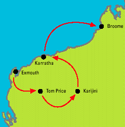
Karijini Gorges Safari 2 DAY SAFARI ADVENTURE
DAY 1 Karratha - Karijini National Park
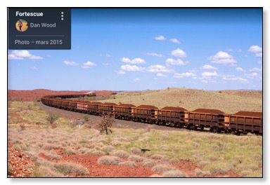
Follow the Hamersley Iron Railway as it traverses the Pilbara countryside
and watch the two kilometres long iron ore trains as they haul their massive loads on their way to port.
After lunch travel to Circular Pool which is surrounded by ferns.
Swim at the base of the waterfall at Fortescue Falls
DAY 2 Karijini National Park - Karratha
Travel to Kalamina Gorge with its rock platform overlooking the pool and waterfall…….
Hamersley Range Air Safari
Experience the breathtaking sights of the Pilbara.
Land near the ranges and be met by your tour guide.
See Hamersley Gorge,Oxer ’s Lookout,Dale ’s Gorge, Circular Pool and Fortesque Falls.Returns to Port Hedland approx.6.00pm.
![]()
The view down Dales Gorge from Fortescue Falls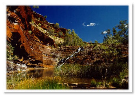 JPEG image 256x384 pixels
 ![]()
17 Day West Coast Wildflowers & Kimberley (1997 )
swagmantours.com.au
…
Day 7 - (BLD)
Pilbara Gorges
Full day touring in the Hamersley Range. Visit Fortescue Falls, Wittenoom,
Dale and Vampire Gorges each with their own rugged individuality.
See wonderful waterfalls cascading from great heights and see the old Wittenoom mine works.
Overnight: Millstream National Park campground.
…
![]()
9 Day Perth-Pilbara-Perth (1997-2000)
travellersclub.com.au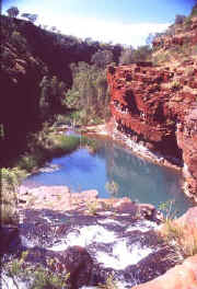
Day 7 - This morning we take a leisurely walk along the bottom of Kalamina Gorge,
then head to Dales Gorge for a hike from the beautiful (and icy-cold) fern-fringed Circular Pool to the stunning Fortescue Falls.
Mid-afternoon we depart Karijini to a camping park at Newman for the night.![]()
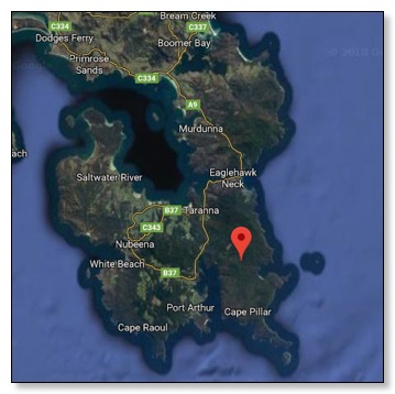
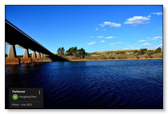
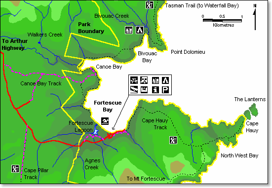
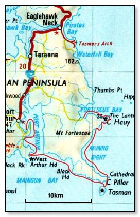
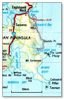
Fortescue Bay
https://www.google.fr/maps/place/Fortescue+Bay/@-43.1299991,147.9512238,2898m/data=!3m2!1e3!4b1!4m5!3m4!1s0xaa6da41737e22849:0x1f104e31e870cec4!8m2!3d-43.13!4d147.96
Fortescue Bay
Tasmanie
Australie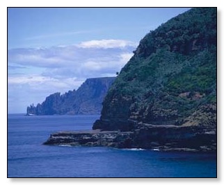
![]()
with Alexandra de Blas
on Saturday 22/04/00 Saturday
http://www.abc.net.au/rn/science/earth/stories/s123006.htm
The Hidden Forest
Summary:
Jeannie Baker's latest children's book The Hidden Forest is about the surreal and disappearing kelp forests in the waters of South East Tasmania.
Details or Transcript:
...
Jeannie Baker: It’s the scene of a kelp forest; it’s actually a particular kelp forest that I explored off Fortescue Bay,
south-east Tasmania, and here there are forests of giant kelp that stretch from the sea floor sometimes to 30 metres in height,
and then they’ll keep growing along the water surface as the forest canopy.
And when you get masses of kelp growing in trees in this kind of way, it becomes a forest, and it’s as complex as a land forest.
So I’m trying to show the wonder and the complexity.
For example on the sea floor, under the shelter of the giant kelp, you see beautiful pink and red seaweeds
and very different creatures living to higher up and in the canopy itself.
....
Alexandra de Blas: Jeannie Baker, speaking there with Janet Parker.
And Jeannie’s new book ‘The Hidden Forest’ is published by Walker Books,
and it’s set a Fortescue Bay on the Tasman Peninsula, which is one of my favourite places.
Guests on this program:
Jeannie Baker
Author
Walker Books
Reporter:
Janet Parker
OPTIONAL ACTIVITY
The Hidden Forest Exhibition - Canberra Museum and Gallery
Featuring the work of Jeannie Baker (limited availability)
Jeannie Baker's work consists of collage constructions that are designed to illustrate Jeannie's award winning picture books,
but stand individually as works of art.
They are included in many public collections and have been exhibited in galleries in London, New York and throughout Australia.
These works are set in a Giant String Kelp forest (Macrocystis pyrifera) in Fortescue Bay, Tasmania.
The exhibition conveys the extraordinary imagery of this precious, vulnerable, rich and complex environment.
It also touches on our attitude to the sea and its plants and animals.![]()
SAIL INTO THE MILLENNIUM DOWN-UNDER
TASMANIA SMALL SHIP ADVENTURE ITINERARY
December 25, 1999 - January 3, 2000
DAY 1 Leave the port of Hobart and travel to Port Arthur penile colony.
This is approximately a 5-hour boat trip. After a delicious dinner on board enjoy a guided "ghost tour" of the settlement.
Return to the boat for evening drinks and snacks.
DAY 2 The next morning will be spent viewing the seal rookery around Tasman Island after departing Port Arthur.
Tasman Island was named after the Dutch explorer "Able Tasman". Upon sailing to Fortescue Bay,
which is approximately a 3-hour trip, the day will be spent bush walking and fishing.
We may not have the biggest or the best, but we sure have plenty of them!
This is a beautiful area in which to explore -- a lovely, quiet bay where you can walk anywhere ashore.
Snorkelling equipment and wet suits will be available for those who are interested.
DAY 3 We will take in the sights of the Eaglehawk Neck and Devil's Kitchen area.
The trip from Fortescue to Eaglehawk Neck will take approximately 2 hours.
The blow hole and convict history surround this area. In the convict days of Port Arthur, troops were stationed across the neck of this passage with dogs and guards.
To keep the prisoners from swimming to shore, they were told that the waters were shark infested and deadly.
After the historical sights, we will sail through Mercury Passage, past Maria Island and Isle Defoc (approximately a 3-hour trip)
re-named by early French explorers, and on into lovely Coles Bay (approximately a 2-hour trip).
Tonight we sleep at local cottage.
Enjoy an evening ashore, for those who wish to go to the local tavern or just relax in the accommodation provided.
...![]()
Tasmanian Branch Report 1997/98
Got the Bait
2/4/1999
...
ATTENTION ALL CLUBS AND MEMBERS
Fortescue Bay Camping Ground and Launching Ramp is going to become part of the Proposed Tasman National Park.
We have an urgent request from The Peninsula Club for all ANSA members to write to The Minister, David Llewellyn,
stating that it would be best not to include the Camping ground and Launching Ramp in the proposed Park.
A petition is being circulated on Tasman Peninsula but this is a matter of access for all fishermen around the State who use the area for recreational fishing.
Paul Fannon, of the Peninsula Club, urges all individual members of ANSA and particularly all Clubs to write as strongly
and as soon as possible to support his Club and your own interests.
...
(www.ansa.com.au)![]()
From
Sailing Alone Around the World,
By
Captain Joshua Slocum, 1900
IX
...
I WAS determined to rely on my own small resources to repair the damages of the great gale which drove me southward toward the Horn, after I had passed from the Strait of Magellan out into the Pacific. So when I had got back into the strait, by way of Cockburn Channel, I did not proceed eastward for help at the Sandy Point settlement, but turning again into the northwestward reach of the strait, set to work with my palm and needle at every opportunity, when at anchor and when sailing. It was slow work; but little by little the squaresail on the boom expanded to the dimensions of a serviceable mainsail with a peak to it and a leech besides. If it was not the best-setting sail afloat, it was at least very strongly made and would stand a hard blow. A ship, meeting the Spray long afterward, reported her as wearing a mainsail of some improved design and patent reefer, but that was not the case.
...
"When you sailed through here before," he said, "you fired a shot at me," adding with some warmth that it was "muy malo." I affected not to understand, and said, "You have lived at Sandy Point, have you not?" He answered frankly, "Yes," and appeared delighted to meet one who had come from the dear old place. "At the mission?" I queried. "Why, yes," he replied, stepping forward as if to embrace an old friend. I motioned him back, for I did not share his flattering humor. "And you know Captain Pedro Samblich?" continued I. "Yes," said the villain, who had killed a kinsman of Samblich--" yes, indeed; he is a great friend of mine." "I know it," said I. Samblich had told me to shoot him on sight. Pointing to my rifle on the cabin, he wanted to know how many times it fired. "Cuantos?" said he. When I explained to him that that gun kept right on shooting, his jaw fell, and he spoke of getting away. I did not hinder him from going. I gave the squaws biscuits and beef, and one of them gave me several lumps of tallow in exchange, and I think it worth mentioning that she did not offer me the smallest pieces, but with some extra trouble handed me the largest of all the pieces in the canoe. No Christian could have done more. Before pushing off from the sloop the cunning savage asked for matches, and made as if to reach with the end of his spear the box I was about to give him; but I held it toward him on the muzzle of my rifle, the one that "kept on shooting." The chap picked the box off the gun gingerly enough, to be sure, but he jumped when I said, "Quedao [Look out]," at winch the squaws laughed and seemed not at all displeased. Perhaps the wretch had clubbed them that morning for not gathering mussels enough for his breakfast. There was a good understanding among us all.
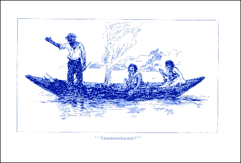
From Charles Island the Spray crossed over to Fortescue Bay, where she anchored and spent a comfortable night under the lee of high land, while the wind howled outside. The bay was deserted now. They were Fortescue Indians whom I had seen at the island, and I felt quite sure they could not follow the Spray in the present hard blow. Not to neglect a precaution, however, I sprinkled tacks on deck before I turned in.
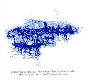
On the following day the loneliness of the place was broken by the appearance of a great steamship, making for the anchorage with a lofty bearing. She was no Diego craft. I knew the sheer, the model, and the poise. I threw out my flag, and directly saw the Stars and Stripes flung to the breeze from the great ship.
...
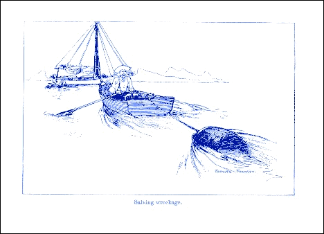
In their mosquito fleet was a ship's boat stolen probably from a murdered crew. Six savages paddled this rather awkwardly with the blades of oars which had been broken off. Two of the savages standing erect wore sea-boots, and this sustained the suspicion that they had fallen upon some luckless ship's crew, and also added a hint that they had already visited the Spray's deck, and would now, if they could, try her again. Their sea-boots, I have no doubt, would have protected their feet and rendered carpet-tacks harmless. Paddling clumsily, they passed down the strait at a distance of a hundred yards from the sloop, in an offhand manner and as if bound to Fortescue Bay. This I judged to be a piece of strategy, and so kept a sharp lookout over a small island which soon came in range between them and the sloop, completely hiding them from view, and toward which the Spray was now drifting helplessly with the tide, and with every prospect of going on the rocks, for there was no anchorage, at least, none that my cables would reach. And, sure enough, I soon saw a movement in the grass just on top of the island, which is called Bonet Island and is one hundred and thirty-six feet high. I fired several shots over the place, but saw no other sign of the savages. It was they that had moved the grass, for as the sloop swept past the island, the rebound of the tide carrying her clear, there on the other side was the boat, surely enough exposing their cunning and treachery. A stiff breeze, coming up suddenly, now scattered the canoes while it extricated the sloop from a dangerous position, albeit the wind, though friendly, was still ahead.
...
![]()
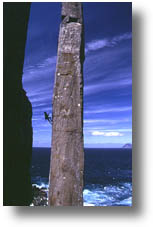
Nicole's Corner 55m 18
This obvious RH corner is situated approx. 30m left of the Totem Pole and Candlestick Normal Route. The climb starts where the sloping ledge emerges from the ocean and continues up past a small triangular ledge at the half way point to a bushy ledge at the top. Step down where the traverse around to the Totem Pole narrows just opposite the climb. Rap off natural pro on a 60 m static, past a sloping ledge into a deep crack and a stance at 5m above the water. From here, belay the swimmer down to the water and across to the sloping ledge at the base of the main corner. Use small nuts at the front of the ledge to set up a tyrolean on the abseil rope. Keep attached to the static when climbing to enable a tyrolean back to the mainland from the top. 1) 30m 18 Take the main corner moving right through the roof at 18m. Continue up to belay at the small triangular sloping ledge. 2) 25m 18 Continue up the corner. Step right into the cave at approx. 18m, then left at the roof to regain the corner and up to belay on the bushy ledge. Although some major cleaning of the route was done on the first ascent, a helmet for the belayer would be advisable as would a torch for the late trek home!!
Diller 5 Jan. 1998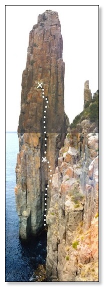
![]()
Some other great bushwalks I've done
Cape pillar - Tasman Peninsula Cape Pillar is reached by driving to Fortescue Bay (about 90 minutes drive from Hobart on the Tasman Peninsula). The walk into the campsite (Pigsty Ponds) takes approximately two hours. You should collect water at Lunchtime Creek about half an hour before reaching the campsite, in case there is none at Pigsty Ponds. There are magnificent views from the 300 metre high cliffs, and Tasman Island is also a fantastic site. This is one of the most spectacular walks I have done, and all for an easy effort to get there.
Cape Hauy - Tasman Peninsula Cape Hauy is reached by driving to Fortescue Bay (about 90 minutes drive from Hobart on the Tasman Peninsula). The walk takes approximately 90 minutes. It is a beautiful coastal walk and on arrival you view seascape from amazing clifftop as seen in these two photos.
(fcms.its.utas.edu.au)
![]()
Sailing Alone Around the World
C H A P T E R V I I
Weighing anchor at Buenos Aires – An outburst of emotion at the mouth of the Plate – Submerged by a great wave – A stormy entrance to the strait – Captain Samblich's happy gift of a bag of carpet-tacks – Off Cape Froward – Chased by Indians from Fortescue Bay – A miss-shot for "Black Pedro" – Taking in supplies of wood and water at Three Island Cove – Animal life
ON January 26, 1896, the Spray, being refitted and well provisioned in every way, sailed from Buenos Aires. There was little wind at the start; the surface of the great river was like a silver disc, and I was glad of a tow from a harbour tug to clear the port entrance. But a gale came up soon after, and caused an ugly sea, and instead of being all silver, as before, the river was now all mud. The Plate is a treacherous place for storms. One sailing there should always be on the alert for squalls. I cast anchor before dark in the best lee I could find near the land, but was tossed miserably all night, heartsore of choppy seas. On the following morning I got the sloop under way, and with reefed sails worked her down the river against a head wind. Standing in that night to the place where pilot Howard joined me for the up-river sail, I took a departure, shaping my course to clear Point Indio on the one hand, and the English Bank on the other.
I had not for many years been south of these regions. I will not say that I expected all fine sailing on the course for Cape Horn direct, but while I worked at the sails and rigging I thought only of onward and forward. It was when I anchored in the lonely places that a feeling of awe crept over me. At the last anchorage on the monotonous and muddy river, weak as it may seem, I gave way to my feelings. I resolved then that I would anchor no more north of the Strait of Magellan.
...
The sloop held the wind fair while she ran thirty miles farther on her course, which brought her to Fortescue Bay, and at once among the natives' signal-fires, which blazed up now on all sides. Clouds flew over the mountain from the west all day; at night my good east wind failed, and in its stead a gale from the west soon came on. I gained anchorage at twelve o'clock that night, under the lee of a little island, and then prepared myself a cup of coffee, of which I was sorely in need; for, to tell the truth, hard beating in the heavy squalls and against the current had told on my strength. Finding that the anchor held, I drank my beverage, and named the place Coffee Island. It lies to the south of Charles Island, with only a narrow channel between.
...
Canoes manned by savages from Fortescue now came in pursuit. The wind falling light they gained on me rapidly till coming within hail, when they ceased paddling, and a bow-legged savage stood up and called to me, "Yammerschooner! yammerschooner!" which is their begging term. I said, "No!" Now, I was not for letting on that I was alone, and so I stepped into the cabin, and, passing through the hold, came out at the fore-scuttle, changing my clothes as I went along. That made two men. Then the piece of bowsprit which I had sawed off at Buenos Aires, and which I had still on board, I arranged forward on the outlook, dressed as a seaman, attaching a line by which I could pull it into motion. That made three of us, and we didn't want to "yammerschooner"; but for all that the savages came on faster than before. I saw that besides four at the paddles in the canoe nearest to me, there were others in the bottom, and that they were shifting hands often. At eighty yards I fired a shot across the bows of the nearest canoe, at which they all stopped, but only for a moment. Seeing that they persisted in coming nearer, I fired the second shot so close to the chap who wanted to "yammerschooner" that he changed his mind quickly enough and bellowed with fear, "Bueno jo via Isla," and sitting down in his canoe, he rubbed his starboard cat-head for some time. I was thinking of the good port captain's advice when I pulled the trigger, and must have aimed pretty straight; however, a miss was as good as a mile for Mr. "Black Pedro," as he it was, and no other, a leader in several bloody massacres. He made for the island now, and the others followed him. I knew by his Spanish lingo and by his full beard that he was the villain I had named, a renegade mongrel, and the worst murderer in Tierra del Fuego. The authorities had been in search of him for two years. The Fuegians are not bearded.
...
So much for the first day among the savages. I came to anchor at midnight in Three Island Cove, about twenty miles along from Fortescue Bay. I saw on the opposite side of the strait signal-fires, and heard the barking of dogs, but where I lay it was quite deserted by natives. I have always taken it as a sign that where I found birds sitting about, or seals on the rocks, I should not find savage Indians. Seals are never plentiful in these waters, but in Three Island Cove I saw one on the rocks, and other signs of the absence of savage men.
...
(www.humboldt1.com)
![]()
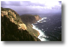
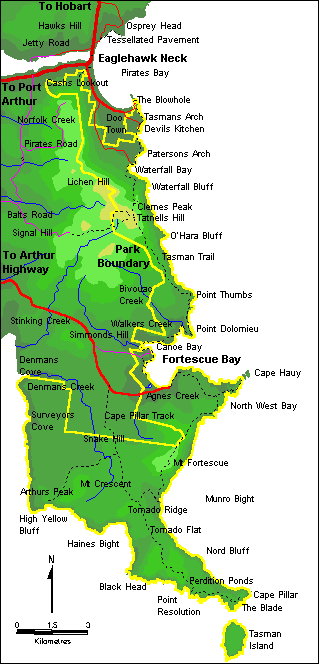
The Tasman Island Lighthouse
The Tasman Island Lighthouse is one of the highest in Australia.
When the light was first established the winds were so fierce that the steel tower would shudder, fracturing the lamps mantles and putting the light out.
History
Tasman Island is one of the two most isolated liqhtstations in Australia, and for that reason, was extremely unpopular with all keepers.
The light is sited on the highest point of Tasman Island, near Storm Bay, which is close to the Tasman Peninsula. The Tasman Lighthouse is known for the height, 250 metres, and steepness of it's cliffs. Once thickly forested, it is now almost bare as the result of the cutting of trees for firewood and of two severe fires.
Between Tasman Island and Cape Pillar, the last point of the mainland in a south-easterly direction, is a narrow passage about 1,234 metres wide
The lighthouse was built in 1906. It is constructed of cast-iron plates, circular in section, bolted together and positioned on a concrete base 26 metres in diameter.
The Surrounding Area
The Tasman Peninsula
The Tasman National Park
Tour of Port Arthur
The Port Arthur Penal Settlement
Cape Pillar
Maatsuyker Canoe Club's Fortesque Bay to Tasman Island Trip
The Iron Pot Lighthouse to the east.
The Cape Bruny Lighthouse to the south.![]()
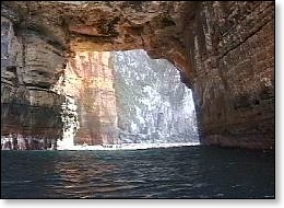
Fortesque Bay to Tasman Island
http://www.vision.net.au/%7Ejennings/pt2/tas/tas.html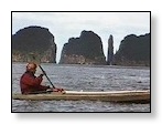
The most spectacular of all the south east coast trips. Along a very exposed coast with no landing spots, this trip is guaranteed to put a crick in your neck, gazing up at the 1000' cliffs. An adrenalin rush is common on this trip. Surf the gap between the candlestick and the Lanterns, creep into sea caves large and small and make a landing on Tasman Island , if you dare. The usual landing spot is a smooth, sloping rock that is washed by the waves. Time your run and your okay. The long climb up the old haulage way on Tasman is worth the effort. You can sleep in the old lighthouse keepers quarters if you are game enough to chance the weather.
There are seal colonies near Cathedral Rock and one year we saw hundreds of Dolphins in Munro Bight. If you are into diving, the wreck of the Nord lies up against the cliffs in 120' of water.
![]()
A TRANSCRIPT OF THE POLICE INTERVIEW WITH
MARTIN BRYANT
Part Three
..
Q. Was the gun loaded?
A. Yeah the gun was loaded, yeah had about eight, nine rounds in it. Mmm.
Q. And where did this take place Martin sorry?
A. At the Fortesque Bay turnoff, just, ohh about three or four minutes away from the Martin's farm.
Q. To which side of ...
A. That was.
Q. ... The Seascape is Fortesque Bay turnoff?
A. Ahh, before you go to Seascape on the way to, on the way to Hobart.
Q. So it's on the Hobart side of Seascape?
...
Part Five
...
Q. Took the BMW, shooting the occupants.
A. Must've been, I told, the BMW was back there at the Fortesque Bay turnoff.
Q. No, the BMW wasn't there
....
(http://www.overflow.net.au)
![]()
Fishing Reports - Tasmania
Fortescue Bay |
| Fortescue Bay |
- Steve Scott.
Date fished: 20/02/99
Time fished: 7:00am - 2:00pm
I fished from: Boat
The action was: Hot
Bait/Lure/Fly used: Hothead lure.
Additional comments:
Trolled northeast to the Shelf from Hippolyte Rock. Caught Albacore & Striped Tuna. Once at the Shelf dropoff we caught plenty of Albacore at 10kg & a few Yellowfin Tuna at 7kg. A few fish were kept and the remainder were released. Conditions were excellent, with wind less than 8 knots & swell below 1.5m. Water temperature was 17°C at Hippolyte Rock, increasing toward the Shelf. Over the dropoff the water turned bright blue & temperature increased to 20°C.
![]()
parks.tas.gov.au
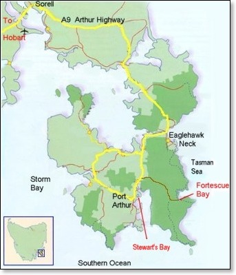
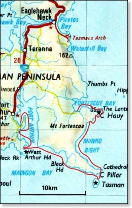
3D Virtual Reality Model of Tasman National Park -
Pirates Bay to Fortescue Bay
To gain a better view of Tasman National Park, take a look at our 3D Virtual Reality Models.
Map of Tasman National Park - Fortescue Bay Area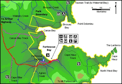

Parks and Wildlife Service Home![]()
![]()
Facilities |

| Map of Tasman National Park - East Section |

Parks and Wildlife Service Home![]()
The Tasman Peninsula, steeped in history, is a ``must see'' for visitors to Tasmania. Filled with natural beauty, horrors of the past are masked by the present tranquility. Nubeena is the largest town on the Tasman Peninsula.
This page gives a regional overview. For more detailed information,
use the links to the left or click the relevant city/town on the map.
Attractions
The Port Arthur Historic Site, at Port Arthur, is one of Tasmania's premiere tourist attractions and takes visitors a step back in time to Australia's convict past. Close to Port Arthur are the Tasmanian Devil Park and a timber milling museum.
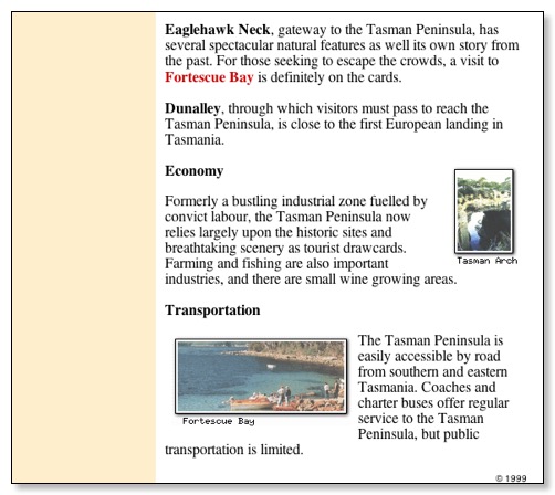
Eaglehawk Neck, gateway to the Tasman Peninsula, has several spectacular natural features as well its own story from the past. For those seeking to escape the crowds, a visit to Fortescue Bay is definitely on the cards.
Dunalley, through which visitors must pass to reach the Tasman Peninsula, is close to the first European landing in Tasmania.
Economy
Formerly a bustling industrial zone fuelled by convict labour, the Tasman Peninsula now relies largely upon the historic sites and breathtaking scenery as tourist drawcards. Farming and fishing are also important industries, and there are small wine growing areas.
Transportation
The Tasman Peninsula is easily accessible by road from southern and eastern Tasmania. Coaches and charter buses offer regular service to the Tasman Peninsula, but public transportation is limited.
___
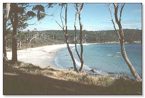
Fortescue Bay |
The campgrounds at Fortescue Bay serve as a good staging point for various bushwalks. A two to three day walk southward to the Cape Pillar State Reserve gives views from the highest seacliffs in Australia, at 300 m (900 ft).
The bay is at the southern end of the Abel Tasman Forest Reserve, and a walk to the north through the reserve goes past Waterfall Bay to Eaglehawk Neck, taking approximately seven hours.
| Fortescue Bay |
![]()
Tasmanian Seaplanes![]()
Flights to Freedom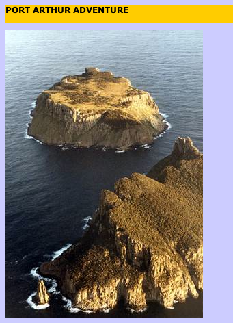
(www.tas-seaplane.com)
![]()
vcserv.seas.smu.edu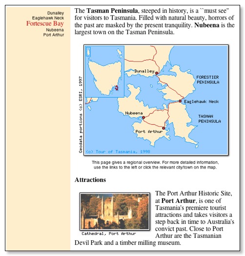
![]()
Free Launching at Fortescue Bay
4th November, 1999.
Cecily Butorac and I attended a field day and barbecue on the Tasman Peninsula today, as part of the National Parks consultative process to develop a Management Plan for the new Tasman National Park. It started off with a meeting in the council chambers at Nubeena, where I would estimate probably 40 to 50 people attended. These were tourist operators, boat owners, bush walkers, hang gliders, local people, sea kayakers, and no doubt other interests were represented as well.
Participants were able to put forward issues that concerned their field of interest, and these were noted down and will go into a draft plan, which will possibly be out in the new year for public comment. Obviously not everyone will get what they want, and there is no compulsion on the part of the Minister to take any notice of the plan anyway. However, Cec and I were impressed with the way the consultation was done. Apparently there have been many informal meetings with different groups already, and the Maatsuyker Canoe Club was asked for input via email some months ago.
We were then taken by bus to Fortescue Bay where a bit of history was disseminated, and more opportunity given for people to air their concerns about certain issues. As a result we were pleasantly surprised to hear that the boat ramp at Fortescue Bay has been designated a 'public' boat ramp, and can be used for launching and retrieving boats (and sea kayaks) without paying an entry fee. It's a great pity that the onsite Ranger didn't bother to explain this a month ago when 5 of us were launching from the beach to paddle up to Lagoon Bay for the night. Almost before we had turned our engines off, she was alongside telling us that this was now a National Park and fees applied - a very unfriendly attitude we thought at the time.
So if you are starting or finishing a trip at Fortescue Bay, use the boat ramp and avoid the entrance fee.
The day finished with an extremely well organised barbecue at the Port Arthur Caravan park, and I was suitably impressed with the large number of Parks people who were circulating around and making an effort to talk to most people there.
For further or ongoing information, email Vicky, or Megan.
Well done Vicky and Megan and Anni, and all the other Parks people who's names I didn't catch. This is far more likely to get the public onside than the dogmatic attitude taken by the person that visited Cec and myself to 'tell' us what the plan was going to be for the Bass Strait Islands National Park.
Laurie Ford
Fortescue Bay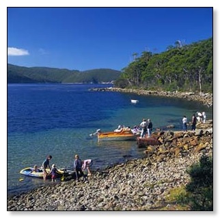
Fortescue Bay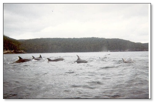
Dolphins in Fortescue Bay
Fortescue Bay![]()
Baidarka Experience
Personalised tours can be tailored to your interest, whether it be birds, wildlife or photography, to provide an idividual experience.
Half day and full day kayaking tours are also available.
Soup and home made fresh bread are provided.
Sea Kayak Tours of Port Arthur and Fortescue Bay Paddle along the spectacular coastline of the historic Tasman Peninsula. See the ruins of Port Arthur from the water, explore secluded bays and beaches and keep an eye out for sea eagles, seals and dolphins. Enjoy freshly baked bread and hot homemade soup on a beach of soft white sand.
A half day trip enables you to also visit secretive Denmans Cove and Safety Cove.
Trips are for one or two people only, groups of friends, or family, so we can arrange the itinerary to suit you. No experience is necessary to paddle the stable double sea kayaks. We supply comfortable warm drysuits, safety gear and instruction. Bring thermal underwear or a light woollen sweater, comfortable soft footwear, hat, sunglasses and sun cream and a change of clothes on shore.
More experienced kayakers may paddle from Fortescue Bay to the spectacular Lanterns at Cape Hauy.
Fortescue Bay |
Fortescue Bay |
Forestry Tasmania
Fortescue Bay |
The Hidden Forest by Jeannie Baker
Nov 2000
The giant kelp forest Macrocystis pyrifera in Fortescue Bay, south east Tasmania, is the inspiration and setting for this exhibition by well known collage artist and book illustrator Jeannie Baker. The exhibition is made up of collage constructions whic
| | |
Port Arthur and Tasman Peninsula 4WD Day TourWe drive to Port Arthur via some forestry roads, have morning tea and then explore the history of the picturesque ruins and old restored cottages at this once grim penal settlement. After lunch we head to peaceful Fortescue Bay for a walk in the sand, or just rest and enjoy the beauty of this isolated area.
Discover Tasmania's unique wildlife and walk among the friendly wallabies and kangaroos at the Tasmanian Devil Park. See orphaned and injured animals nursed back to health at the State's only wildlife rescue centre.
Marvel at the extraordinary coastal formations - the Tasman Arch, Devils Kitchen and Blowhole - at beautiful Eaglehawk Neck.
![]()
![]()
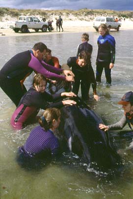
Marion Bay Whale Stranding - Preliminary Summary
SUNDAY 18TH OCTOBER
The Parks and Wildlife Service wishes to thank all those people who have kindly volunteered their time to assist in the rescue effort. Their efforts have resulted in many whales being saved.
Evening light aircraft flight from Grindstone Point to Fortescue Bay including Maria Island done. Confirmed 3, possibly 4 live whales in Blackman Bay.
MONDAY 19TH OCTOBER
Light aircraft flight done of area - Grindstone Point to Fortescue Bay. No new strandings sighted.
TUESDAY 20TH OCTOBER
0600 hrs. light aircraft flight done, no new stranded whales sighted, from Fortescue Bay to Grindstone Point and all Maria Island.
Continued with burial of whales at Rheben and Marion Bay. Burial completed by 1200 hrs.
WEDNESDAY 21ST OCTOBER
0840 hrs. One whale sighted 40 metres offshore in shallow waters at Marion Bay main beach.
1200 hrs. Light aircraft flight of area from Grindstone Point to Fortescue Bay including Maria Island - no new strandings. Only the one whale in shallow water at Marion Bay Beach.
RESULTS
Another important lesson learnt is that all ariel surveys must be done of a large coastal area. Unfortunately, the first flight of this stranding (0600 hrs. Sunday 18th October) only covered the immediate area around Marion Bay. If it had gone from Grindstone Point to Fortescue Bay, we would have identified the stranded whales at Rheben. With the deployment of people and vessels earlier we may have saved more whales at the Rheben site. It has been reported that if we had more vessels at Rheben on Sunday the whales would not have re-stranded as many times.
![]()